England’s Cure To Crazy Driving…Kinda
Okay, so I recently did a driver’s safety course for speeding.
Wait, wait, wait… it wasn’t that bad.
I was going down a hill on a 30, and at the bottom it switched to a 20. I’d never driven on that road before, and it took me a second to adjust. Personally? I think it was fine. But hey… the DVSA does indeed have bills to pay.
Anyway, I’m sitting there on the course, slightly humbled, slightly annoyed… and I learn something I had genuinely never heard before.
Apparently… the motorway is watching you.
Not in a conspiratorial way.
In a data way.
There’s something called a smart motorway. And once you see it, you realise it’s everywhere in the UK. It’s the reason you’ll be cruising at 70… and suddenly the signs tell you to go 50… then 40… and you’re sitting there thinking:
“There’s literally nothing here… why am I slowing down?”
So let’s talk about what’s actually going on.
Data In The Wild
Welcome back to another edition of Data in the Wild the series where we investigate how data is quietly collected, processed, and used to shape the world around us.
Today’s conversation:
The motorway that thinks ahead of you.
What Is A Smart Motorway??
At it’s simplisest, a smart motorway is just a motorway that uses real-time data to manage traffic.
English roads, for all you non-UK drivers are pretty small. They were originally built for horses and carrgiages after all, so rather than building new lanes (which is expensive, slow, and disruptive), this system tries to optimise the road we already have.
- Variable speed limits
- Lane control (including that red X)
- Sensors tracking traffic flow
- And in some cases… removing the hard shoulder entirely
So rather than reacting to traffic…
it tries to predict and shape it.
According to the BBC, as of April 2024 there were 396 miles of smart motorways in England:
- All-lane running motorway – hard shoulder permanently removed – 193 miles
- Controlled – hard shoulder retained and variable speed limits – 140 miles
- Dynamic – hard shoulder sometimes open to traffic – 63 miles
Forgive the use of a pie chart it just felt like it must be done
So…Why Does It Tell You To Slow Down When Nothing’s There?
This is where it gets interesting.
Under the road (and around it), there are sensors constantly collecting data:
- How fast are cars moving
- How close together they are
- Whether traffic is starting to bunch up
All of that feeds into a system called
MIDAS (Motorway Incident Detection and Automatic Signalling).
Truly a golden opportunities to use a good acronym. Here’s what the MIDAS actually does:
- It looks for patterns that suggest congestion is about to happen
- And then intervenes before you even see the problem
The Red X, for the slightly seasoned readers out there, may make you think of a certain teen titan, but for the rest of us normal people, it can be a bit confusing! Why? Because it looks like the lane is not usable, which is only half the story! Rather, the motorway has picked up that there is an accident, an obstacle, or something that makes it not the best place to be, so kindly get out of the lane! Here is what’s happening:
- The system detects an issue (breakdown, debris, etc) via radar or CCTV
- Closes the lane
- Updates the signs
There are even cameras that will fine you if you ignore it.
Because on some smart motorways…there’s no hard shoulder anymore.
It does occur to me as I write this, there are a lot of terms here where if you don’t drive or don’t drive in the UK, may make not sense what so ever, but the hard should is that part of the road the arrow is pointing to in the picture, where cars tend to go when the going gets tuff and your vehicle stops going…it’s gone!
Some smart motorways use something called “all lane running”, where the hard shoulder is permanently turned into a live lane.
Which is great for:
- Increasing capacity
- Reducing congestion
But raises a very fair question:
Where do you go if you break down?
Enter: Emergency Refuge Areas
Instead of a continuous hard shoulder, you get designated pull-in zones called Emergency Refuge Areas (ERAs).
They’re:
- Painted bright orange
- Placed roughly every 1–1.5 miles
- Equipped with SOS phones
The idea is If something goes wrong, you aim for one of these
But…That gap between them? That’s where a lot of the debate comes in.
The Debate
Yes, there is one! It’s why a good chunk of us get up in the morning! Because on paper, smart motorways may sound great!
You have:
- Less congestion
- Faster Journeys
- Lower emissions
But in reality, alot of people are not completely sold. Organisations like the RAC have raised concerts that around how quickly stopped vehicles are detected and the distance between the refugee areas. Amongst other things, one of the biggest concerns is the reliability of data & tech to handle safety issues in a predictable way, for a species of people who are not exactly known for their predictability (I have been on a few Reddit threads about this, it’s both very scary and incredibly entertaining).
It’s as a result of this that the UK government has actually cancelled plans for new smart motorways, though the existing ones are very much in use.
The Bottom Line
As we are not here to talk about motorway hijinks and government policy, we are here to talk about how data is used and influences our everyday lives. And this is one of the examples where, perhaps there is still a big question mark. Because we’ve built a system powered by data…but we are still figuring out if we actually trust it.
Next time you’re driving and the speed drops from 70 to 50 for no obvious reason…
Just remember:
It’s not random.
It’s not broken.
It’s a system, quietly watching patterns…
trying to stop a problem before you ever see it.
And whether you trust it or not…
That’s data in the wild.
See you next time.

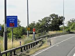
Data in the wild #17: Smart motorways
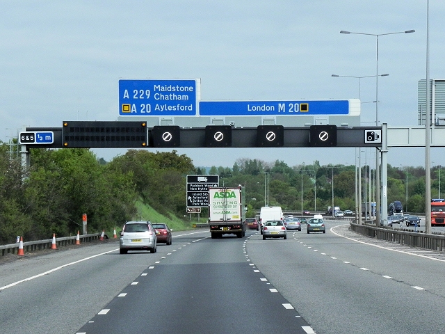
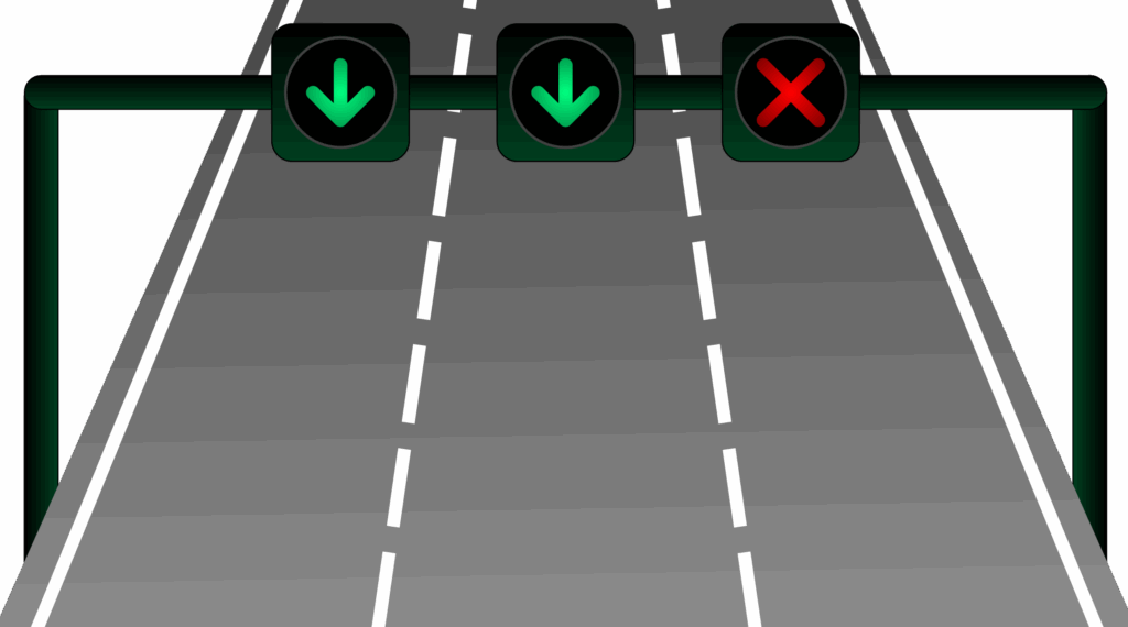
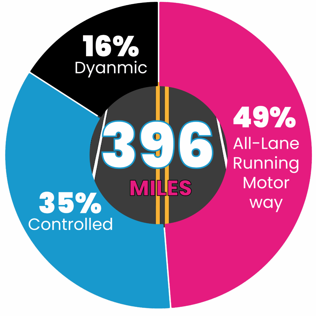
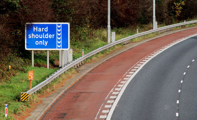
Smart motorways are quietly shaping how we drive. That sudden drop from 70 to 50? It’s not random. Sensors and systems are predicting traffic before it happens, slowing everyone down to prevent jams. It’s data controlling the road in real time… the question is, do we actually trust it?

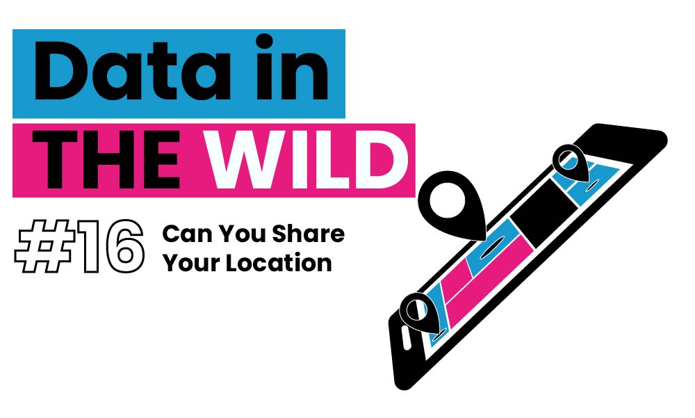
Data in the wild #16: Can You Share Your Location
In this edition of Data in the Wild, I explore what it really means to “share your location.” From GPS and Wi-Fi to ship tracking and TfL demand modelling, this piece unpacks how geolocation works, where it shows up in everyday life, and what we can build when movement becomes data.

Data in the wild #15: The Data Behind Fireworks
Fireworks don’t just light up the sky they’re shaped by data. From wind modelling to sound limits, invisible thresholds decide what counts as “safe fun.” This Data in the Wild piece explores how decibels, maths, and regulation quietly shape one of our most beloved celebrations.