Data in the wild #15: Can You Share Your Location

Data in the wild banner, can you share your location

Location Is Key

So, I recently took on an interesting client project. It was interesting for many reasons, but a big one was a key feature they wanted for their digital product. They wanted the ability to track the live locations of their research ships as animated points on a map of the ocean in the section they were mapping.

I’m not gonna lie to you or them, this was a first. I mean, it’s one thing to ask your friend to share their location with you; it’s another thing to manage that for several ships. It was definitely a challenge, but thanks to the age where we all interact with location data to some degree, it seemed and felt very doable. So I said, “We’ll do it and figure it out together.” As with any new skill, I went down a rabbit hole because, all of a sudden, I had to become a geolocation IoT expert (a goal I did not reach). It taught me a lot about what it actually means to turn on your location and the different ways that data can be used. So let’s dive into what it really means to send your location.

Welcome to Data in the Wild
Welcome back to another edition of Data in the Wild, the series where we investigate how different data is formed, collected, and used to influence the world around us. I’m excited to jump into this topic because it’s a data and technology source that anyone can really use… with consent!!

What is Geolocation?

Let’s start with the basics. What is Geolocation? According to Investopedia, “Geolocation is the ability to track a device’s whereabouts using GPS, cell phone towers, WiFi access points, or a combination of these. Since devices are used by individuals, geolocation uses positioning systems to track an individual’s location down to latitude and longitude coordinates, or more practically, a physical address.”

In other words, it is a method that uses different forms of technology to track your location, so no matter where you go, as long as you have a device that can access the internet or in some way connects to a network They. Can. Find. You!

Let’s Go Over The Different Ways To Do This:

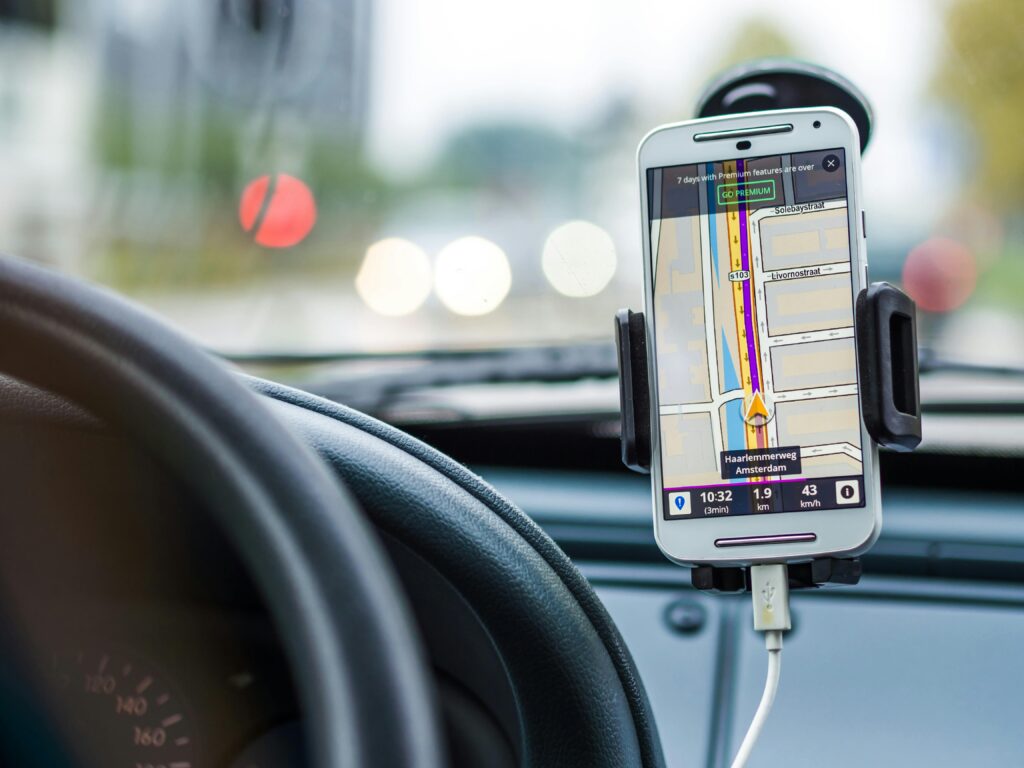
GPS: Also called the Global Positioning System. The one we all know and love, and if you are anything like me, reminds you of the first Jurassic Park. This is the most accurate way of locating an object and does not require the internet! The device uses a receiver to directly receive signals from a network of satellites orbiting the Earth, and yes, most smartphones have a built-in GPS.

Cell Phone Towers: This is also called network-based geolocation. Your phone provider’s infrastructure determines your location through a process called network triangulation. Which sounds super complicated but boils down to determining a device’s location by drawing triangles between it and known network points, like slicing a pizza, with your device at the centre and the crust edges the different cell towers. Since this is based on network providers, the location accuracy depends on the network coverage in that area. So if you decide to get lost in the mountains, you’ll find out if OS really is essential for living (Purely for the UK audience).

Wi-Fi access points: Also called Wi-Fi positioning, it is the lightest-weight way of finding locations and, in my view, the most interesting. Essentially, every Wi-Fi router, at all times, broadcasts a unique identifier as if it were a landmark on a giant Wi-Fi map (which companies have been building for years). So, when Wi-Fi is on, your device can see many nearby Wi-Fi networks, each with its own unique ID. Your phone identifies all of these (even if it doesn’t access them), so as it passes through and identifies them, your device’s location can be determined, similar to how you find where you are on a map based on the landmarks on a street. The only thing is that, unlike all the other methods here, wifi is most accurate within 10 meters (cause it’s a radio wave). Which means within buildings it is optimal, but at a distance…not as much

IP address: This method can be used by any device that can connect to the internet…which is a lot in today’s world. Every device, when it goes online, is given an IP address; it’s how the internet knows where to send information back to. But the IP addresses are not random; they are assigned in regional chunks that can be at the country level, city level, and sometimes as deep as the neighbourhood. Behind the scenes, there are large IP location databases that map IP addresses to your device’s location. The catch is that it cannot provide specific longitude & latitude coordinates, but it can provide a general area.

Bluetooth: works similarly to Wifi access points. Most devices have Bluetooth capabilities, so when Bluetooth is turned on, your device passes other Bluetooth beacons that broadcast their positions, allowing your device to be located based on proximity.

Okay, Cool! That’s How It Works, But How Do We Use This?

Audience Research & store locations

Probably the one most of us know! It includes things like footfall data, which is like a heat map of people traffic. It helps you know where people tend to frequent, so you can, for example, decide where to put your next food truck or store. You can also use location-based ads, which leverage social media tools to better target the audiences you need to reach with your online ad. It even includes Uber Eats, which uses your location to show you the best dining options nearby. Marketing and advertising have been using geolocation to make ads more efficient, so that they only speak to people who can connect with them not only on a personal level, but also on a practical level (meaning they can actually get to the shop to buy the item in a reasonable time).

TFL and Travel

Before you get spooked, TFL isn’t secretly tracking your phone everywhere you go in London (at least not to my knowledge). Rather, every time you tap your Oyster card or contactless at the station, it creates a time-stamped, location-based record that tracks you to a specific point in the transport network. Do that for the millions of taps and journeys made in a day alone, and TFL are able to create a map, a live picture of travel demand, by day and time to know which routes are busiest and how peak travel patterns shift (those peak charges were by no means a random guess). You can imagine that as routes expand when people move out of London, this will be imperative when deciding how to further expand train lines. Buses actually have GPS, allowing us to have real-time arrival boards so we know how long we’ll have to wait at a stop.

SUBSCRIPTIONS

Yes!! You may or may not have noticed that if you use Netflix, Amazon Prime, or even YouTube in different countries, you get very different content. That’s because the sites use geolocation data to serve relevant content to that demographic. So if you live in India, you may get a lot more Bollywood on Netflix than if you live in the UK. Or if you live in the US, you may not even have access to certain shows or movies because their licenses do not allow them in other regions. Which is why you see certain ads on YouTube showing off VPNs, because they allow you to get around the geolocation issue by changing the region of your IP address.

Where Do We Find Geolocation Data?

After hopefully sparking some curiosity about geolocation, it would be really mean of me to leave without pointing out a couple of places you can get geolocation data for free!! A good number of companies offer access to geolocation data for a fee. I am not endorsing any of them, so I’ll let you peruse the web to find that, but there are a few that you can get for free:

  • Open Street Maps (OSM)
  • The London Data Store (for the public transport data I mentioned before)
  • Google Geolocation API (They actually have a few, so really check them out!)
  • Natural Earth
  • NASA & ESA Open Datelitte Data
  • Government Open Data Portals (Many governments allow access to geolocation data they collect)

It always surprises me how much data and information are collected on a daily basis without any of us knowing. But what’s even crazier is how accessible a lot of it is… for free!! That’s what makes working with data so exciting. The question is rarely, “Does this data exist?” It’s usually, “If it does… what could we build with it?”

See you next time for another Data in the Wild

Data in the wild banner, can you share your location
Data In The Wild

Data in the wild #15: Can You Share Your Location

In this edition of Data in the Wild, I explore what it really means to “share your location.” From GPS and Wi-Fi to ship tracking and TfL demand modelling, this piece unpacks how geolocation works, where it shows up in everyday life, and what we can build when movement becomes data.

Read More →
Data In The Wild

Data in the wild #15: The Data Behind Fireworks

Fireworks don’t just light up the sky they’re shaped by data. From wind modelling to sound limits, invisible thresholds decide what counts as “safe fun.” This Data in the Wild piece explores how decibels, maths, and regulation quietly shape one of our most beloved celebrations.

Read More →
Data In The Wild

Data in the wild #14: Light, Lasers & LIDAR

Imagine mapping the world using light. That’s exactly what LiDAR does. It fires laser pulses that bounce off objects and return to a sensor, calculating distances with GCSE-level physics. Repeating this millions of times creates point clouds detailed 3D maps. From mapping cities to powering self-driving cars, LiDAR reveals the invisible.

Read More →